
Lifestyle
Central Texas Outdoor Guide: Best Trails Near Georgetown and Austin
 Kelly LadnerSeptember 29, 202611 min read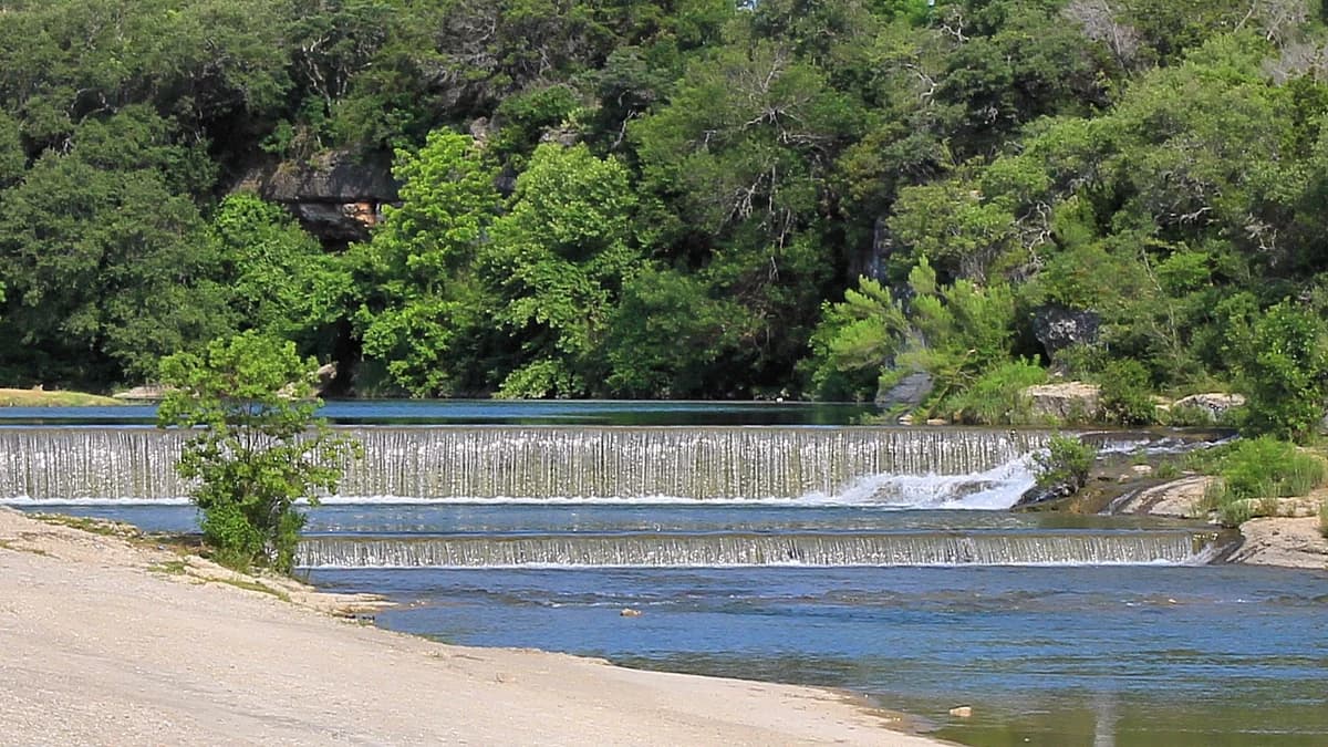
One of the questions I get asked the most has nothing to do with houses. It's some version of, okay, but what's actually out here to do?
So here's my answer. These are the ones I'd point you to, from five minutes off the Georgetown square to the ones worth a tank of gas.
You don't need all of them. My honest advice is to find the two or three that fit how you actually spend a Saturday, and ignore the rest.
Real mileage, real trailheads, and what you'll pay as of September 2026.
What's actually here in Georgetown?
Georgetown's built around two rivers, and the trails follow the water. The city keeps more than twelve miles of them.
You're never far from one, and that isn't an accident. The San Gabriel is the reason a lot of people stop looking anywhere else.
The Randy Morrow Trail is the backbone at about 5.35 miles, and part of it's lighted, which I'd take over the alternatives in winter. The South San Gabriel River Trail adds about 4.15 miles of concrete.
The San Gabriel Park Loop is 1.9 miles of granite path a few minutes from the courthouse square. That's the one for an hour you didn't plan on having.
The Winfred H. Bonner Trail is the lighted mile that'll drop you at Blue Hole Park. Blue Hole's the limestone swimming hole on the South San Gabriel, and it's the picture people send home. If you only get one stop out of my whole list, make it that one.
If you're new to Georgetown, start at the square and work outward. It's the fastest way to get your bearings.
Rivery Park has natural-surface singletrack, open since 2021. It's minutes off I-35, which to my mind is the whole point of it.
Then there's Garey Park. Jack and Cammy Garey gave the city 525 acres west of town, and it opened in 2018.
You've got more than seven miles of trail out there. About 4.68 miles are shared with horses on crushed limestone, and 2.6 miles are red granite for walkers only.
There's a splash pad, a dog park, and two fishing ponds too. The city lists hours as 8 to 8 April through September and 8 to 6 the rest of the year, though seasonal hours move, so check before you drive out.
Garey is the one I'd show you if you want the feel of land without the price of it.
Berry Springs Park and Preserve is the quiet one. A hike-and-bike trail along Berry Creek, a heritage pecan grove, two resident donkeys, and you don't pay a thing.
That's my pick for a Saturday morning with nobody else in it.
How long is the Good Water Loop, really?
Lake Georgetown is where I'd send you for a real day on foot.
The Good Water Loop runs about 26 miles of rugged trail all the way around the lake, and it finishes on top of the North San Gabriel Dam. The Army Corps of Engineers manages it.
You don't have to do all 26, and I wouldn't try it on a first visit. Cedar Breaks Park is mile zero on the mileposts, so the usual approach is to walk out a few miles and turn back. Almost nobody does the full circle in a day.
You'll find parking at Russell Park, Tejas Camp, Overlook Park, the Nature Center, and the Stilling Basin on Booty's Road.
If you've got two cars, drop one and walk it point to point. That's the best version of this trail.
Mountain bikers care about this one. It's got an IMBA Epic designation, and I don't think people realise how unusual that is to have on your doorstep.
There's a paved, accessible stretch from Overlook Park down toward the river too, where it ties into the city system. I'd flag that one for anybody whose knees have opinions, because not every trail here works for every body.
What connects Round Rock and Cedar Park?
Brushy Creek Regional Trail is the connector. About 7.75 miles of mostly concrete running from Round Rock into Cedar Park, ending at Twin Lakes Park.
Williamson County's been building it in phases for years, and the newest stretch just opened west of Chisholm Trail Road.
It works better as a landmark than the roads do. If you're comparing Round Rock and Cedar Park, it's the thing that ties them together, and it's underweighted in most of those comparisons.
Lake Pflugerville Trail, if you're heading that direction, is about three miles of crushed granite around a 180-acre reservoir. You've got a small beach, fishing piers, and kayak rentals.
Bring a hat. There's almost no shade on that loop.
When should you drive into Austin instead?
The Ann and Roy Butler Hike-and-Bike Trail is what people mean when they say the trail. Austin Parks and Recreation calls it a 10-mile loop around Lady Bird Lake.
The boardwalk piece is 7,250 feet of it, out over the water on the south shore. Go early, and go on a weekday if you can. It's the busiest trail in the region.
The Barton Creek Greenbelt is the other side of Austin. It's a rocky limestone corridor with several access points and the swimming holes people drive across town for.
From the Loop 360 lot you're a short walk from Twin Falls, and about a mile and a quarter further to Sculpture Falls. They only hold water when Barton Creek's running.
Check recent conditions before you promise anybody a swim. That creek can go from swimmable to dry inside a month.
Turkey Creek Trail at Emma Long is the one I'd name if you asked me about dogs. It's a 2.8-mile lollipop with a creek you'll cross over and over, and the City of Austin designates it off leash. Your dog will be filthy. That's the deal.
The Austin trails are genuinely good. The argument for living up the corridor isn't that they aren't, it's that you'll use what's ten minutes away and you won't use what's forty-five.
Which ones justify a longer drive?
Balcones Canyonlands National Wildlife Refuge is the sleeper on this list.
It's free, dawn to dusk, every day of the year, and I'd give it a morning rather than an hour.
There's about nine miles of foot trail across the public units. Doeskin Ranch has the creek and pond walks, and Warbler Vista has the observation decks off FM 1431 near Lago Vista.
It's protected habitat for the golden-cheeked warbler, so it stays quiet. You'll hear more birds than people.
Milton Reimers Ranch Park sits on the Pedernales with canyon and river trails, more than 18 miles of mountain biking, and some of the best sport climbing in the state.
Travis County lists the entrance fee as cash, so bring some rather than find out at the gate.
Pedernales Falls State Park is the layered-limestone river scene you've seen on a postcard, and it earns the drive. Hamilton Pool Preserve is the photograph everybody's seen, and you need a reservation every single day of the week.
Don't drive out to Hamilton Pool on spec. Getting turned around at that gate is a long way back.
What does it cost to get outside here?
| Trail or park | Where | Distance | Cost as of September 2026 |
|---|---|---|---|
| Georgetown city trails | Georgetown | 12+ miles total | Free |
| Good Water Loop, Lake Georgetown | Northwest of Georgetown | About 26 miles | About $4 per vehicle |
| Garey Park | West Georgetown | 7+ miles | $2 resident, $4 nonresident, 3 and under free |
| Berry Springs Park and Preserve | Northeast of Georgetown | Hike-and-bike trail | Free |
| Brushy Creek Regional Trail | Round Rock to Cedar Park | About 7.75 miles | Free |
| Lake Pflugerville Trail | Pflugerville | About 3 miles | Free |
| Butler Hike-and-Bike Trail | Downtown Austin | About 10 miles | Free |
| Barton Creek Greenbelt | South Austin | About 7.5 miles | Free |
| Turkey Creek Trail | West Austin | 2.8 miles | Free at the trailhead |
| Balcones Canyonlands NWR | Near Lago Vista | About 9 miles | Free |
| Milton Reimers Ranch Park | On the Pedernales | 18+ miles of biking | $5 per person, $3 age 62+, cash |
| Pedernales Falls State Park | West of Austin | Varies | $6 per person, 13 and up |
| Hamilton Pool Preserve | Western Travis County | Short walk in | $12 reservation plus $8 per adult, cash |
Almost all of it is free. You'll spend more on gas getting to these places than you'll spend on entry.
If you're going to hit the state parks more than a few times, buy the Texas State Parks Pass. It's $70 a year and covers 88 parks as of September 2026.
Fees change, and reservation systems change faster. Confirm current pricing with the managing agency before you load the car.
Which trail fits the day you actually have
Do you have an hour, or a whole Saturday? Pavement or dirt? Is there a dog, a horse, or a swim involved?
Answer those three and I can sort the list for you.
- An hour between things. My picks: San Gabriel Park Loop, the Bonner Trail down to Blue Hole, or Rivery Park.
- Flat and paved. South San Gabriel River Trail, Brushy Creek, or the Lake Pflugerville loop.
- A hard day on foot or a bike. Good Water Loop, in whatever bite you want. I'd start at Cedar Breaks.
- Water at the end of it. Blue Hole in town, Twin Falls or Sculpture Falls when the creek's up, or Hamilton Pool with a reservation.
- Horses. Garey Park, which is unusual for a city this size.
- Quiet. Balcones Canyonlands or Berry Springs, early, on a weekday. That's the combination I'd protect on a calendar.
- Dogs off leash. Turkey Creek at Emma Long.
None of those is better than the others. It's a fit question, not a ranking.
What this means if you're buying or selling here
Here's the part I care about most. Trail access is one of the few lifestyle claims about a house you can actually check on a map. So check it.
Read the neighborhood's trail map, not its marketing. I'd do that before I got attached to anything. Wolf Ranch sits above the South San Gabriel and it's built around an internal trail network, but confirm what connects today rather than what's coming at build-out.
The golf and estate neighborhoods usually sit on the best ground. Cimarron Hills is built around a Jack Nicklaus Signature course on the west side, and Berry Creek's the established option closer in.
Both put you near the high ground and the river corridors, which tends to matter more to how a place feels than the finishes do.
Pull the trail map before you write an offer, not after.
Sun City has its own large internal path network, which matters if 55-plus housing is part of your search.
My last piece of advice: check the easement, not the view. That greenbelt behind the lot might be permanent public open space, a future street, or a drainage right-of-way.
The plat will tell you. The listing photo won't, and that gap is how people end up losing the yard they thought they were buying.
If you're selling near a trailhead, name it. Half a mile to the Randy Morrow Trail lands harder than close to trails, every time.
And go test the access the way you'll actually use it. Park where you'd park, on a Saturday, at the hour you'd really go. I always encourage people to do that before they commit to a house.
My goal isn't just to help you buy a house. It's to help you find a place where the Saturdays feel like home.
If you're thinking about moving to Georgetown or anywhere along this corridor, I'd love to help you figure out which trail ends up being the one at the end of your street.
Verification notes
Every figure above is current as of September 2026. Confirm before you act on it. Trail mileages vary by source depending on which segments a map counts.
The Good Water Loop gets cited between about 26 and 27 miles, and the Barton Creek Greenbelt between roughly 7.5 and 12.7 miles depending on whether side trails are included. Berry Springs acreage and trail mileage aren't published on the county page, so I haven't given a figure here.
Day-use fees, reservation requirements, park hours, and water levels at every swimming hole named above change seasonally. No Wolf Ranch trail mileage is given here, because the community's published figures aren't independently verifiable.
Sources: City of Georgetown trails and Garey Park. U.S. Army Corps of Engineers, Lake Georgetown trails and Corps parks. Williamson County, Brushy Creek Regional Trail and Berry Springs Park and Preserve. Austin Parks and Recreation, Butler Hike-and-Bike Trail. U.S. Fish and Wildlife Service, Balcones Canyonlands NWR. Travis County Parks, Reimers Ranch and Hamilton Pool Preserve. Texas Parks and Wildlife, Pedernales Falls entrance fees and state park passes. City of Pflugerville trails. Accessed September 2026.
Frequently asked questions
- What's the best hiking trail near Georgetown, TX?
- If you want a real hike, it's the Good Water Loop at Lake Georgetown. It's about 26 miles of rugged trail around the whole lake, and it finishes on top of the North San Gabriel Dam. If you've only got an hour, I'd send you to the San Gabriel Park Loop instead, which is 1.9 miles of granite path minutes from the courthouse square.
- How long is the Good Water Loop, and do I have to hike all of it?
- It's about 26 miles for the full circle, according to the Army Corps of Engineers, and no, you really don't. There's parking at Cedar Breaks Park, Russell Park, Tejas Camp, Overlook Park, the Nature Center, and the Stilling Basin on Booty's Road. Most people park at Cedar Breaks, walk out a few miles, and turn back.
- Are the trails around Georgetown free?
- Almost all of them. The city trails, Berry Springs, Brushy Creek, Lake Pflugerville, the Butler Trail in Austin, and the Barton Creek Greenbelt are all free to walk. As of September 2026 the Corps parks at Lake Georgetown run about $4 a vehicle and Garey Park is $2 for residents, $4 for everyone else. Confirm current pricing before you go.
- Can I actually walk to a trail from a Georgetown neighborhood?
- In some of them, yes, but check it rather than assume it. Pull up the city trail map next to the plat before you fall in love with a greenbelt lot. What looks like permanent open space is sometimes a drainage easement or a future street.
- Where do people swim around here?
- Blue Hole Park in Georgetown is the limestone swimming hole on the South San Gabriel, and it's the one people send photos of. Down in Austin, Twin Falls and Sculpture Falls on the Barton Creek Greenbelt are the classics, but they only hold water when the creek's running. Hamilton Pool is the famous one and it needs a reservation every day of the week.
- Which trails near Austin let dogs off leash?
- Turkey Creek Trail at Emma Long Metropolitan Park is the one everybody names. It's a 2.8-mile lollipop with creek crossings the whole way, and the City of Austin designates it off leash. The trailhead itself is free, though the main Emma Long park area charges separately.
- Is the outdoor life up here really different from Austin?
- The difference isn't the quality of the trails, it's the friction. From most of Georgetown you can be on the San Gabriel in about ten minutes without planning anything, and that tends to change how often people actually go.
If you want a home where the trail starts near your back gate, let's talk about which neighborhoods actually connect to one.
Kelly Ladner helps buyers and sellers across Georgetown and Williamson County with honest, local guidance. Reach out for a no-pressure conversation about your goals.

Written by
Kelly Ladner
Kelly Ladner is a Georgetown, Texas real estate agent serving Williamson County and the greater Austin area. She helps buyers and sellers navigate Central Texas neighborhoods, market conditions, and relocation decisions with straight answers and local expertise.
Keep reading
What Is It Really Like Living in Georgetown TX?
What a normal week in Georgetown actually looks like, from the square and the San Gabriel River to the drive into Austin, the August heat and what homes cost as of 2026. A local realtor's honest take.
55+ Communities in Georgetown TX: Beyond Just Sun City
Sun City is the name everyone knows, but it isn't the only 55+ community around Georgetown. Here's where else I'd look, from Heritage Oaks and Texas Traditions to Regency at Santa Rita Ranch in Liberty Hill, with what each one's listing for right now.
New Construction in Georgetown TX: What Buyers Need to Know
About four in ten homes for sale in Georgetown right now are brand new. Here's where they're being built, what they cost, and what I'd check on taxes, inspections and the contract before you sign with a builder.